

We finally reached our final stop i.e. Kyanjing Gompa(3900m) and we were still uncertain of the weather. It was a hard time trekking due to unexpected monsoon, landslides and leeches along the way. But when we finally reached the destination, it was totally worth the risk. And this post is all about how it was worth the risk.
So fasten your seat-belts for the most memorable post that you might ever see. Your will get to see everything that i did above 3900m and i will ask you all to hold your tears(I couldn't actually!).
It was a hard and a rainy the day before(Check out my post worth it) and we had no hopes for this day as well. So we had already made a decision that we wouldn't trek higher to Kyanjing Ri(4300m).
But we woke up to a surprise. The weather was all clear when it mattered the most. So we decided to a further trek. And it was the most memorable day we ever had.

Early morning from our hotel room
There were mountains all around us and we all started jumping and shouting. So i took some early morning photographs and they came out so good and so colorful.

Just outside the hotel

Behind the Hotel

Mountains were starting to show up everywhere and we were greeted by amazing colors
Then it started becoming brighter and i started taking panoramas and what not. The wonderful village of Kyanjing Gompa, which was all dark and gloomy when we arrived the day before, was now the most beautiful village i had ever seen.

The view was even more amazing.

The same view with our hotel in the foreground
Then i decided for a wide angle panorama shoot to show the entire village and the mountains surrounding them and this is how it came out.

Then we started planning for our trek that day and decided that we would reach upto Kyanjing Ri( 4300m) and then end our trek. We asked locals about the route and about time, packed some water bottles and snacks and left for the ascend. And yes, we had our breakfasts too. We were told it would take us about 2hrs for an ascend of 400m i.e. ( 4300m -3900m)
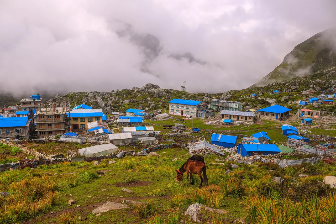
After a small ascend, we got to see the entire village of Kyanjing Gompa and those shiny blue roofs. The village is popular for yak farming and you can get local yak cheese here.

The beautiful village at 3900m was now looking so small.
Then we started seeing clouds moving so fast but we were told not to worry because the weather still looked fine. Also, we started seeing clear view of the mountains. Breathing was becoming faster now that we started gaining altitude but the soothing view all around helped us forget that.

Baden Powel Peak
Now it was the steepest part to the top and we started taking breaks every 5 minutes for acclimatization. The village was now very very tiny.

The tiny village from almost the top
Then, within no time, we reached the top and it was a wonderful moment. It took us only about 1.30 hrs to reach the top and it was an achievement for us. It was my third time above 4000m and fourth above 3900m and maybe i was now more habituated to the height than ever.
We started shooting time-lapses and videos. I had my phone setup for time-lapse(Checkout this video for amazing timelapse view)

and i have also a gif ready for you guys below.

I would recommend GIF to load once and then you see it for smooth intended view
We were now on the lower peak of Kyanjing Ri(4300m) and the higher peak(4773m) was clear but we decided not to go there as we were told the view was similar and the trail was even more risky due to landslides.

Kyanjing Ri Higher Peak(4773m). Also the langtang glacier is visible on top-left

The lantang glacier
When there is sufficient sunlight, the glacier breaks down for an avalanche but we didn't get to see that. Also we could now see one of the sources of river origin and what looked like a lake on the mountain base.

The source of lantang river

Rivers originating from mountains
We were already late now and so, we took one last view of the village before we decided for our way down.

One last view

I also took one last panorama shot of the mountains
After about 30 minutes, we descended our entire ascend and we were back to the village at 3900m and it ended up being the most memorable day of our trek.
As always i would like to hear your response. This time i would like to know if you are adventurous or not and would love to hear your similar experiences.
All videos, timelapse and photos created by @cave-man using Canon 200D and Xiaomi Redmi Smartphone