Last time, I showed you some of my methodology when it comes to forming rivers and vegetation for a new continent map - this time for Alacantis - which features in my next book. The final maps will be posted over the next three days. The book itself will begin on Monday.
Country boundaries
I created a new layer for my country boundaries and just drew them in fairly quickly for reference. I discovered that the tool on Photoscape was better for this, so this was just a temporary layer on GIMP.
Town placement - Think like a settler
Anyone who has ever played Civilization knows what I'm talking about. Anyone who has studied maps of foreign countries will also understand. Cities and towns aren't formed at random. There is always a reason for its location.
Cities formed at the mouths of rivers, at places where people could cross the river easily, at the foot of an important mountain, along an important trade route... you get the picture. There's always a reason!
Of course, a map at the scale I am using won't include all the cities and towns, just the major ones. There will be other places along the way.
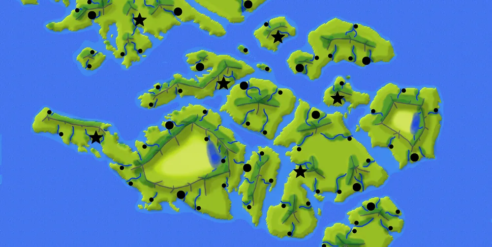
BTW, on GIMP, I used a new layer (currently the top layer) for my city dots and stars.
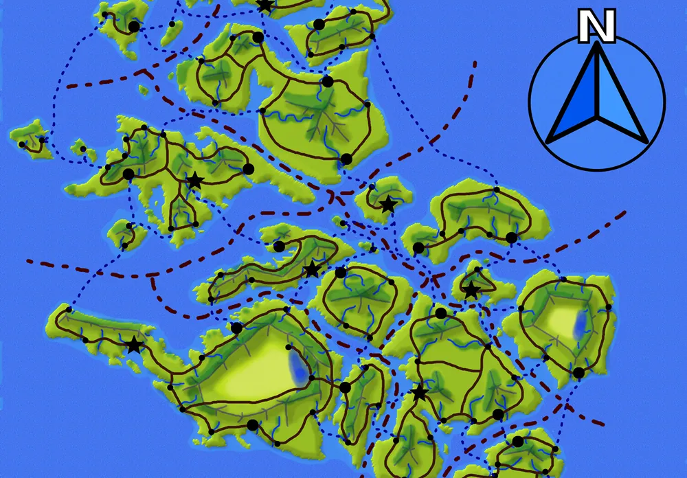
Roads and Boat routes
Again, I think like a settler or traveler. Often, the roads would skirt the coast, because it's a good landmark. Same with tall mountains. But people are also inherently lazy, so shortcuts eventually become roads.
I also added my boat routes at this point. Again, thinking of ease of travel. Hugging the coast was often the safest option, so those are more common.
Boundaries
The line tool in Photoscape was wonderful on this. (If it exists in GIMP, I haven't found it yet.) I could choose a dotted line, draw it in and then it magically made the perfectly dotted line!
Compass Rose
This is a Pixabay addition. It already had a transparent background, so adding it was as simple as "open as layers" and adjusting the new layer to suit.
Here is my map at this point.
Labeling the map
My final step was done on Photoscape as I like the lettering tool there better than the equivalent on GIMP which is unnecessarily complicated.
Each country got named and labeled.
I also cropped each of the countries separately for future labeling. Of course, the Tephsa map got labelled too - and that one will be posted tomorrow morning (Mountain Standard Time.)
Here is my final map of Alacantis with labels, margins (another tool I like on Photoscape) and resizing to work better on this platform.

(This post is crossposted at Steemit, Whaleshares, WeKu and Bearshares.)

Lori Svensen
author/designer at A'mara Books
photographer/graphic artist for Viking Visual
now also on: Whaleshares and WeKu
Banner by @shai-hulud