

This weekend I took a trip to Northern Arizona. I went for a woman's retreat at a cabin in Forest Lakes. I will post about Forest Lakes soon, it is also gorgeous.
Before going to the retreat I stopped to get sunrise pictures at Mogollon Rim.


While living in Arizona I have had heard people talking about "The Rim" and thought they were talking about the rim of the Grand Canyon. It turns out it is Mogollon Rim.
In case you are wondering how to pronounce it Mogollon is pronounced "Muggy-on"
It is a 200 mile long geological feature that cuts across the northern part of Arizona and into New Mexico. "The Rim" cuts through three national forests. The pictures I got from are looking out onto the Tonto National Forest.
In the picture below you can see some of the limestone or sandstone cliffs that make up "The Rim".


Here are a couple of maps for to help you see where it is in comparison to Phoenix. Most of the people in Arizona live in Phoenix or its surrounding cities which are called "The Valley" The pictures are a map of 43.2 miles of the rim from Trek Now which shows paved back roads.


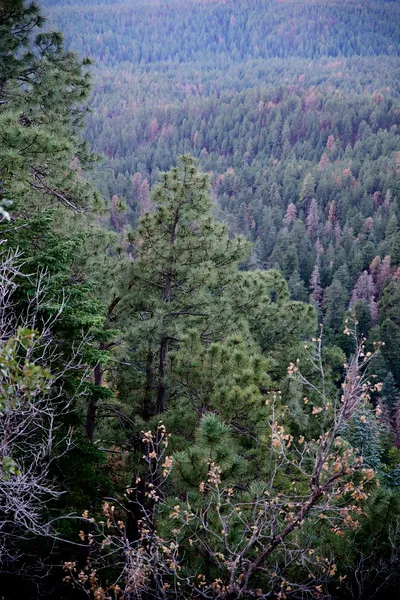
I stopped first to see the view from the visitors center which, is run by the forest service.


Gorgeous view of the Ponderosa pines from the observation deck.

 |  |  |
|---|
I was fascinated with the pine needles against the blue sky.

 |  |  |
|---|
The morning light was so gorgeous.


 |  |  |
|---|---|---|
 |  |  |
My friend texted to see where I was and if I was ok. I was great! I told her I was still taking pictures. So many beautiful scences to capture.


More views from another lookout along The Rim Road. There are many pullout spots with great views down unto the plateau.


After 11 years of living in Arizona I got to experience a completely new place.
It goes to show that there is often much to see and explore right where we are living.