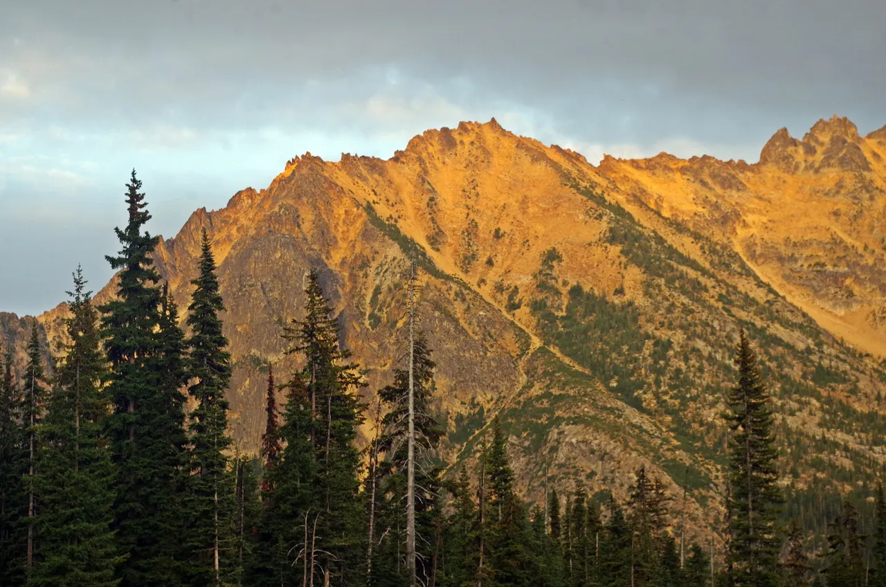
(Kangaroo Ridge from Washington Pass Summit.)
After reaching the mainland from the islands, we continued East on Highway 20 up into the Cascade Mountains.
This was just a view at a wayside which I investigated. It wasn't easy to see much, so I didn't get many photos.


This glimpse through the trees shows some of the devastation that forest fires can cause. I didn't catch which year this one burned, but I suspect it might have been part of the 2015 fires which were so devastating across NE Washington that year.
With all this standing dead, it's ripe for another fire, plenty of fuel.

Finally, just as the sun was setting we reached Washington Pass, elevation 5477 feet, the highest point on this part of the journey.
This beautiful view was right in front of us, so we stopped so I could snap a few. It was only when I wrote up this article that I discovered it had a name - Kangaroo Ridge!
(Image available from RedBubble , TeePublic , and PicFair .)


Photos taken by myself in August 2019 with my Pentax K30.
[//]:# (!steemitworldmap 48.523974 lat -120.654553 long Washington Pass and Kangaroo Ridge d3scr)
Previous issues of Wistful Washington
Ferry County, Washington
Olympic Peninsula, Washington
Destruction Island , Evening Pacific View , Powerful Pacific , Ruby Beach
The Puget Sound
Crossing Puget Sound , Deception Pass Bridge and State Park , Waiting for the Ferry , Winter Baker
Washington Flora and Fauna
Lori Svensen
author/designer at A'mara Books
photographer/graphic artist for Viking Visual
(Buy my work at RedBubble)
verified author on Goodreads
find me on Twitter